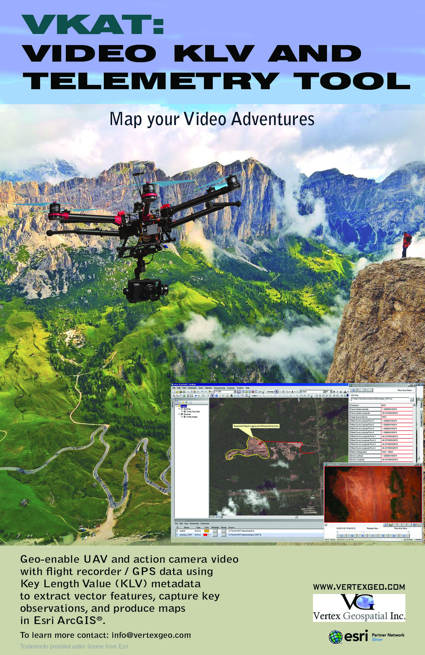
Map Your Video Adventures!
The Video KLV and Telemetry tool, VKAT merges video from UAV and action cameras with GPS data recorders to create intelligent video content that enables advanced analytical and mapping capabilities in a GIS environment. The ability to map FMV content is quickly finding an important role in Search and Rescue operations, wildlife tracking/monitoring, and cinematography projects.
 Commercial Unmanned Aerial Vehicles (UAV’s) are quickly becoming the preferred platform in the commercial, civil and scientific sectors for low altitude acquisition of action videos, aerial imagery, and production of precision 3D surface models. Equipped with a multitude of potential sensors, these platforms possess the ability to collect data in support of various GIS and remote sensing applications. You can learn more about integrating video with ArcGIS® by visiting the Esri® E380 page:
http://video.esri.com/watch/2805/introduction-to-the-fullmotion-video-add_dash_in.
Analysts are beginning to employ video content in GIS environments just as raster imagery has been used for the last 20 years. To succeed, users require “Intelligent” video content that becomes a requirement for advanced analysis and mapping. In concept, adding multiplexed metadata to video is much the same as adding an attribute table to a shape file. Without the data (DBF), the SHP file is just a graphic representation, but with the data table, the SHP file becomes GIS content. The same can be said of video with KLV. The video becomes the graphic (SHP) and the KLV is the data (DBF). From there the sky’s the limit (or the sea, racetrack, savannah, mountain, etc).