
Project Description
Terrain Development
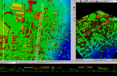
DEM/DTM Development
Client: Rettew Associates
Techncial POC: Ms Carrie Meyers
Rettew Associates 3020 Columbia Avenue Lancaster, PA 17603 717-394-3721 cmeyers@rettew.comProject Period of Performance: 10/2009 – 11/2009
Technology Employed:
- ESRI ArcGIS ArcView
- Virtual Geomatics Software
- LiDAR LAS data
Project Description Vertex Geospatial was hired to create an ESRI Terrain surface using LAS tiles from the Pennsylvania statewide LiDAR collection for Tioga and Lycoming Counties. Existing hydrologic and transportation features (roads & railroads) were incorporated into the terrain surface definition as breaklines. ArcGIS 3D Analyst tools were used to create a bare earth surface model on which proposed natural gas drilling wells and transmission pipelines could be draped.
The deliverables included geometrically correct and dimensionally accurate surface models to support planning, field routing, designing, and construction of a natural gas exploration system in the Marcellus Shale Formation of northern Pennsylvania.
Project Details
- Client Rettew Associates
- Date November 7, 2009
- Tags LiDAR, Terrain Development
Comments are closed.