
Project Description
Technical Support & Training
ArcGIS Training / 911 Dispatch Geocoding
Client: Franklin County Emergency Services
Technical POC: Mr John Bashaw
Franklin County Emergency Services 55 Bare Hill Road Malone, NY 12953 518-483-8584 jbashaw@co.franklin.ny.usProject Period of Performance: 11/2009 – 12/2009
Technology Employed:
- ESRI ArcGIS ArcView
- ArcGIS ArcCatalog
- Positron 911 database
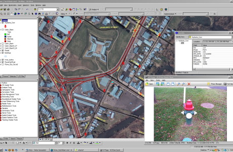
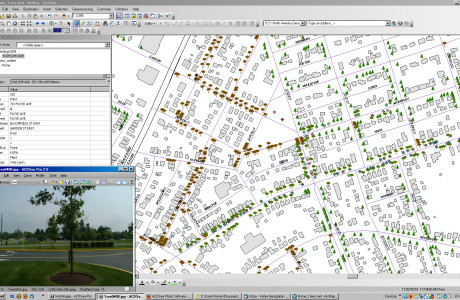
Project Description Vertex Geospatial conducted two days of on-site GIS training in support of the Emergency Services Dispatch Center in Malone, NY During the course of conducting training exercises, Vertex Geospatial staff provided guidance and support to E-911 staff with the following:
- Development of Fire district mapping and EMS response zones
- Radio Network mapping High Band, Low Band and Microwave networks
- Creation of County address locator engine using NYS street centerline file
- Geocoded dispatch database from Positron 911 system and created address points with owner information
- Generated process for adding and editing street segments with addressing data to county road network using ArcGIS desktop tools
Project Details
- Client Franklin County Emergency Services
- Date December 12, 2009
- Tags Emergency Services, Geocoding, Training
Comments are closed.